Kabah, a fascinating Maya city was a first-class and the political hub of the Puuc region. Located at the southern end of a regional axis with Uxmal and Nohpat, it was closely linked to these cities through a network of sacbé (stone roads) and shared kinship ties, further highlighting its importance in the Mayan civilization.
The name Kabah has sparked debate among historians and archaeologists. Some suggest it means “Lord of the Strong Hand”, “The Hand that Carves,” while others believe it could translate to “the one below” (kabal). The true origin of the name remains a mystery, but either way, Kabah’s significance in the Maya world is undeniable.
The city is built in a hilly region, with many of its residential groups perched on natural rises. This elevated terrain provided a commanding view of the surrounding landscape, while the semi-evergreen seasonal forest added a layer of natural beauty.
A Network of Cities
Kabah’s strategic location made it an integral part of a larger network of cities. The sacbé that connects Kabah to Uxmal and Nohpat likely extended to other important cities, such as Oxkintok. To the southeast of Kabah, other Maya cities like Sayil, Xlapak, and Labná formed a cluster of settlements, all sharing cultural and political ties with this Maya City. Smaller sites like Chetulich and Mulchic dotted the landscape, contributing to a complex web of interconnected Maya communities.
Kabah site map

A. CodzPop
B. Palace
C. The Arc
Other structures
1. South Pyramid
2. Sacbé 2
3. Quadrangle
4. Teocalli
5. Building of the Columns
6. House of the Royal Badge
7. The Great Pyramid
8. Early Group
9. Group of the Viewpoint
10. Red Hands Building
11. Sacbé to Uxmal
Kabah’s History
Kabah’s history dates back to 400 B.C., and it reached its peak between 300 and 1000 A.D. In the 19th century, explorers John L. Stephens and Frederick Catherwood documented Kabah, taking some artifacts back to New York. Later, in the 1950s, renowned archaeologist Alberto Ruz excavated the site, focusing on its most famous structure, the Codz Pop, and the monumental Arch.
Despite the lack of surface water, its residents adapted to the environment by tapping into underground rivers and storing rainwater in chultunes (cisterns) and natural depressions. The Maya’s ingenuity in harnessing their environment is a testament to their resourcefulness, as they built a thriving civilization despite the challenges posed by the land.
Kabah Archaeological Site
Kabah is a shining example of Puuc architecture, characterized by intricate facades, elevated platforms, and open spaces. The city is dominated by several monumental structures, each with its own significance:
Codz Pop (Palace of Masks)

Its most iconic building, the Codz Pop features over 250 masks of the rain god Chac on its west façade. The east façade is equally impressive, with images of warriors, mats, and ritual scenes, including a depiction of an important person’s capture and death.
Palace Plaza
This area showcases the best of Puuc architecture, with notable structures like the Temple of the Sun, Teocalli, and the Palace.
The Arch
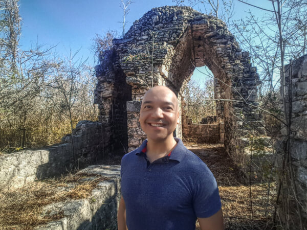
This monumental arch marks the entrance to this Maya city´s sacbé and symbolizes the city’s connection to Uxmal.
Temple of the Columns and Great Pyramid
These structures are other highlights of Kabah’s architectural landscape, offering further insight into the city’s political and religious life.
Exploring this Archaeological site

Visiting this place is like stepping back into the ancient Maya world. The Codz Pop and Teocalli provide excellent viewpoints to take in the city’s full grandeur, while the Palace Plaza and surrounding structures offer a deeper understanding of Puuc architecture. The Manos Rojas structure and Early Group reveal a glimpse into everyday life in Kabah, while the Great Pyramid and Arch remind visitors of the city’s political and spiritual significance.
Kabah may not be as famous as Uxmal, but its architecture, history, and role in the Puuc Maya network make it a must-visit site for anyone interested in ancient civilizations. From the intricate carvings of the Codz Pop to the stunning vistas from the Teocalli, Kabah offers a unique glimpse into the lives of the Maya elite and their deep connection to the land and the gods.
How to get there
Nestled 120 km from Mérida, Kabah is easily accessible via the old Campeche road, just 22 km from Uxmal and 6 km from the town of Santa Elena.


