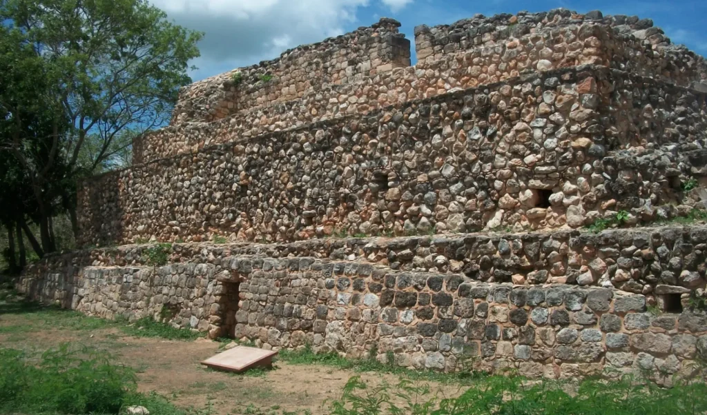
Oxkintok, a pre-Columbian Maya site located in Yucatán, Mexico, is a place steeped in rich history and cultural significance.
The name Oxkintok is often interpreted as “Three Sharp Suns” or “Three Days Pedernal.” Historically, it has also been referred to as Maxacan or Tzat Tun Tzat.
The site’s architecture is a unique fusion of styles from the Puuc region combined with influences from central Mexico, reflecting the diverse cultural interactions of its time.
Oxkintok archaeological site map
A. El Satunsat o Laberinto
B. El grupo Ah May
C. El grupo Ah Canul
D. El grupo Millet
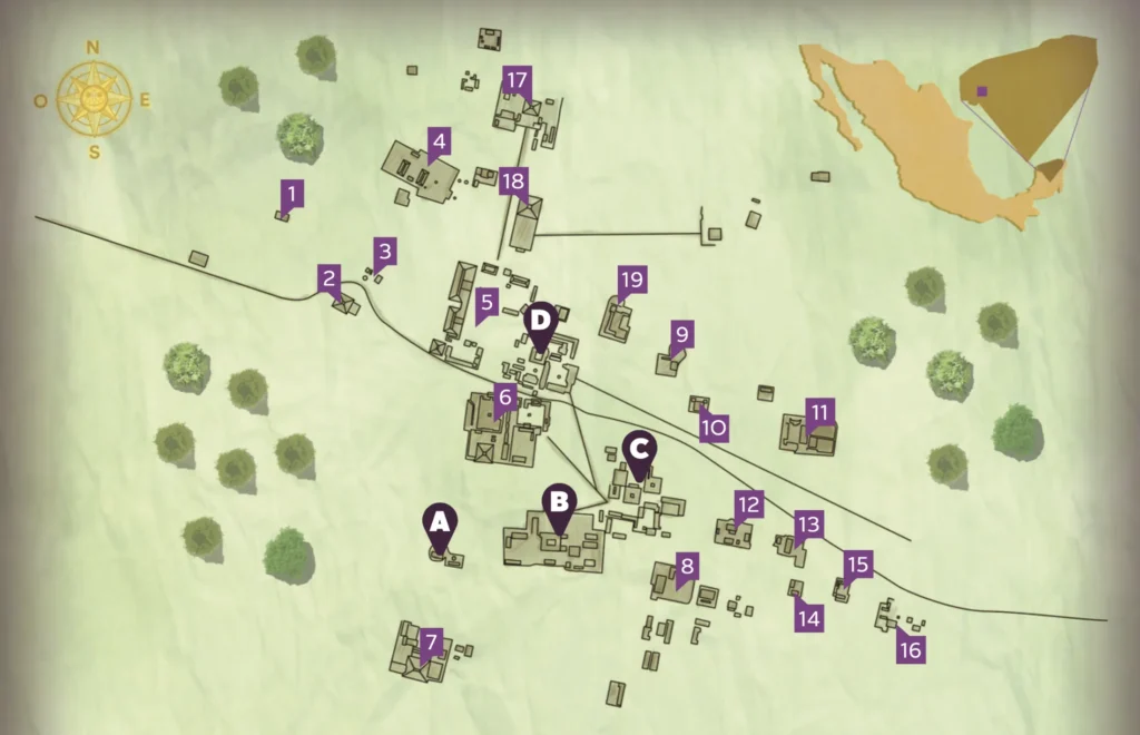
Other structures
- Balam
- Irma
- Hacienda
- Landa
- Kamul
- Zbid
- Xanpol
- Ciudad Real
- Keb
- Kol
- Alfonso Ponce
- Uc
- Ixim
- Rada
- Cogolludo
- Moo
- Donato Dzul
- Chi
- Poot
Oxkintok’s History
Middle Preclassic period
The city’s history spans several important periods. Oxkintok was first occupied during the Middle Preclassic period (500-300 BC), continuing to thrive into the Postclassic period (1000-1450 AD). Its golden era occurred during the Early Classic period (300-550 AD) when it emerged as a major political power in the region. This rise to prominence was largely due to its strategic position on key trade routes that linked the Yucatán peninsula with the Gulf of Mexico and the Central Highlands. During this period, many of Oxkintok’s pyramids and its characteristic Early Oxkintok style palaces were constructed. Its influence extended far, even impacting the ceramic production of northern regions like T’ho, the ancient city that later became Mérida.
Early Classic
In the late Early Classic (6th century AD), Oxkintok entered a period known as Oxkintok Regional, during which it prospered and became a hub of architectural innovation. The site saw the construction of grand buildings, elaborate sculptures, and royal tombs, with architectural styles transitioning into what is known as Proto-Puuc. This period is especially notable for the development of vaulted structures that would become a hallmark of later Puuc architecture.
Late and Terminal Classic periods
As the city continued into the Late Classic period, a ruler named Walas (according to epigraphic data) came to power in the first half of the 8th century. His reign marked a period of centralized authority, with evidence pointing to a consolidation of power around this figure. However, by the Terminal Classic period (850-1000 AD), the dominance of the Puuc architectural tradition in Oxkintok coincided with the city’s gradual decline, as regional power likely shifted to the nearby city of Uxmal.
Postclassic
During the Postclassic period, the city’s architecture underwent further modifications. Palace facades were altered, shrines were erected, and offerings were deposited, particularly in the Ah Canul Group, which appears to have held special ceremonial significance. The city’s layout and construction reflect a blend of various Maya architectural styles, including Petén influences from Guatemala and the distinctive features of the Puuc region. Key architectural groups, such as the Ah Dzib, Ah May, and Ah Canul groups, were likely the centers of political power and home to the city’s elite lineages. These groups are connected by ancient roads, known as sacbe’oob, forming a grand plaza. In total, archaeologists have uncovered thirty-nine groups of structures at Oxkintok, with the longest sacbe stretching 650 meters. The entire site covers a protected area of 953 hectares.
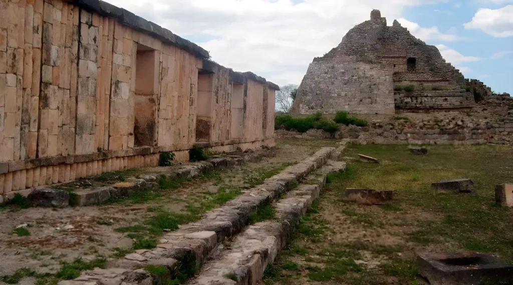
Oxkintok archaeological site
Among Oxkintok’s most notable structures are the Satunsat and the Grupo Ah May. The Satunsat, a three-level building, features a labyrinthine design with a single entrance on its west side. Built on a rocky slope, its vaulted passageways and small openings are believed to have served as skylights or ventilation, with some scholars speculating that they may have had astronomical purposes. The design of the Satunsat is thought to represent the Maya cosmological view of the universe, with its three levels symbolizing the underworld, the Earth, and the sky.
Oxkintok is also home to one of the earliest recorded Maya ball courts, and a remarkable mosaic of a bird crafted from spondylus shell—a material sourced from both the Pacific and Caribbean regions—further highlights the city’s far-reaching trade connections.
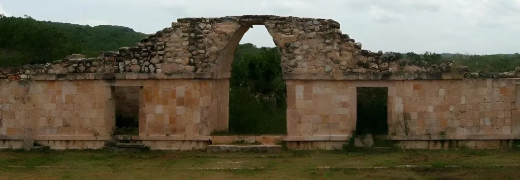
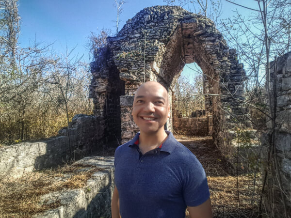
In the Ah Canul group’s Plaza del Arco, visitors can witness the equinox, similar to the phenomenon observed at Dzibilchaltún, another important Maya site. This celestial alignment is one of the many features that emphasize the Maya’s deep connection to astronomy.
How to get to Oxkintok
For those eager to retrace the steps of the Maya, you can get there via Highway 261 from Mérida towards Campeche. Upon reaching the intersection, take Highway 31, known as the Ruta Puuc. Located near Sayil, Kabah, and other Mayan Cities.
It’s opened daily from 8:00 am to 5:00 pm, offering a glimpse into a magnificent past.

